Norwegian Buerbreen Glacier is an arm of the large Folgefonna glacier, which with an area of 214 km2 is the third largest in Norway in the national park of the same name. This glacier arm reaches into the Buerdalen valley, to which there is a branch in the well-known town of Odda.
A very narrow road, 5 km long, named Buervegen, leads to the parking lot where the hike to the Buerbreen Glacier begins. We drove a car 7 m long and 2.22 m wide, but… I don’t dare to say whether with some reserved space, since Garmin didn’t even list this road as allowing for a car with such dimensions. The road ends at the parking lot and parking there is charged NOK 185 NOK per 24 hours.
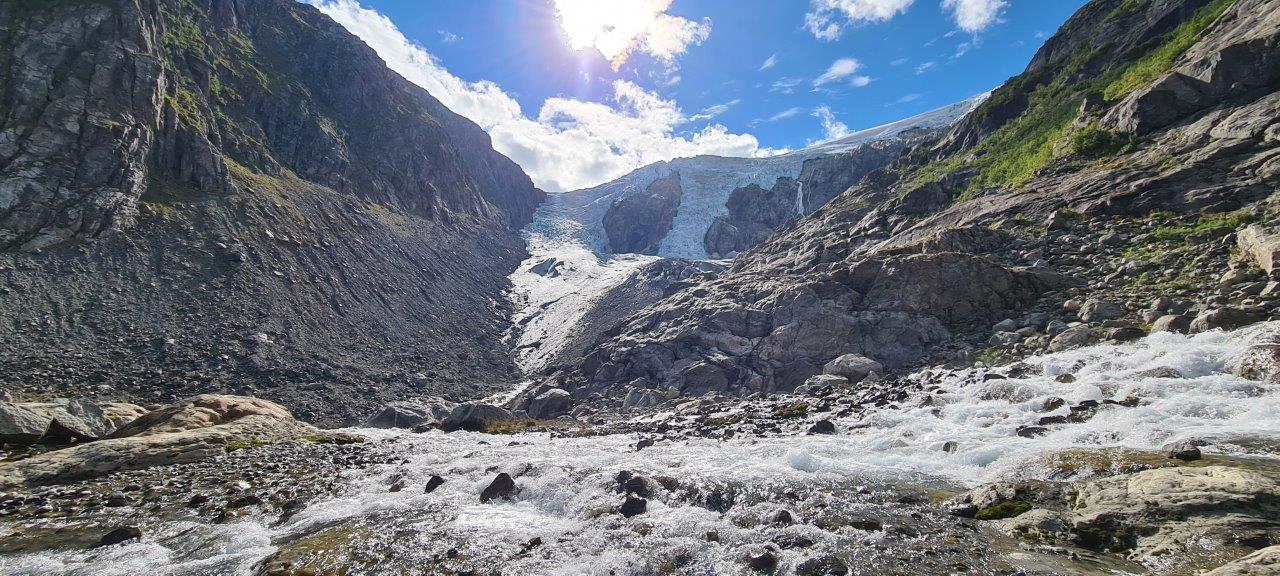
The relatively calm start of the Buerbreen hike does not at all suggest an adventurous hike. But the trail not only gets steeper and steeper but almost halfway along the route there are ropes, which were very convenient to hold on to and pull on to climb up the rocks, with a noisy roaring river somewhere below us, which flows into the Sandvinvatnet lake at the end of the valley. During the entire hike, we have a view of the Buerbreen glacier.
As with any strenuous hike, there is a sweet reward at the end. Our reward was not only the views from above of the beautiful Buerdalen valley and the peaks surrounding it but also the view of the glacier itself and the waterfalls cascading from it at the final point of the route.
And so the top of the route reveals all the beauty of this place. A bluish glistening glacier tongue, right next to it rolling waterfalls, the whistling of the wind and the feeling of a cold coming from the glacier…. All this made the hike a wonderful and very special experience. The hike out& back means about 5 km only, but it is not easy – neither physically nor emotionally.