Hoher Nock 1.963 m
Kalkalpen National Park protects the last big forest wilderness of Austria, with the longest natural stream system in the Eastern Alps. On the territory of the park, there are also spectacular canyons and gorges, picturesque waterfalls, and lakes to admire.
Even though there is no parking space specialized for campers, we can say that the national park is a camper-user-friendly park. On the territory of the park, there are parking lots where the overnight is permitted or at least not prohibited and where the camper visitors can start their hiking or mountain biking trails.
We visited the following parking lots:
1) Parking Lot Reichraming, Weißenbachstraße 17:
It is a beautiful quiet place. We overnighted there as an only camper. There are no amenities, and no water. There are two chemical toilets.
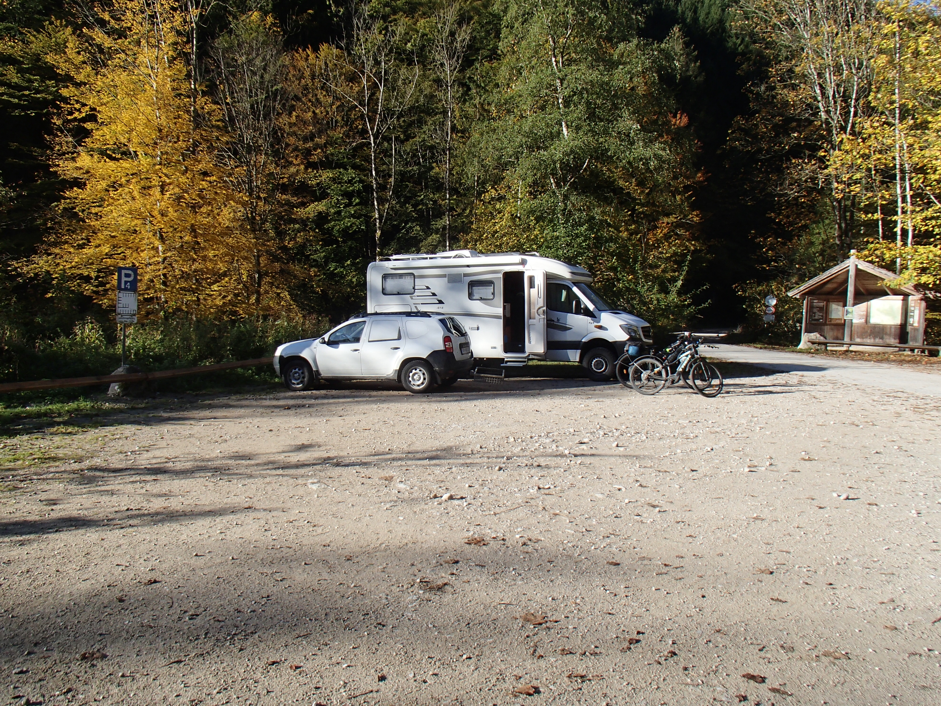
GPS: 47.8555556,14.4541667
There are satellite coverage and a mobile signal too. We recommend this place for campers who intend to do mountain biking or hiking trails which start directly on the parking lot. We did a mountain biking trail and the details about that trail are here.
2) Parking Lot Rettenbach, the lower place:
It is a parking lot for hikers especially. There are no amenities, no water, no toilet. There are satellite coverage and mobile coverage too. We overnighted there, it is a beautiful and very quiet place:
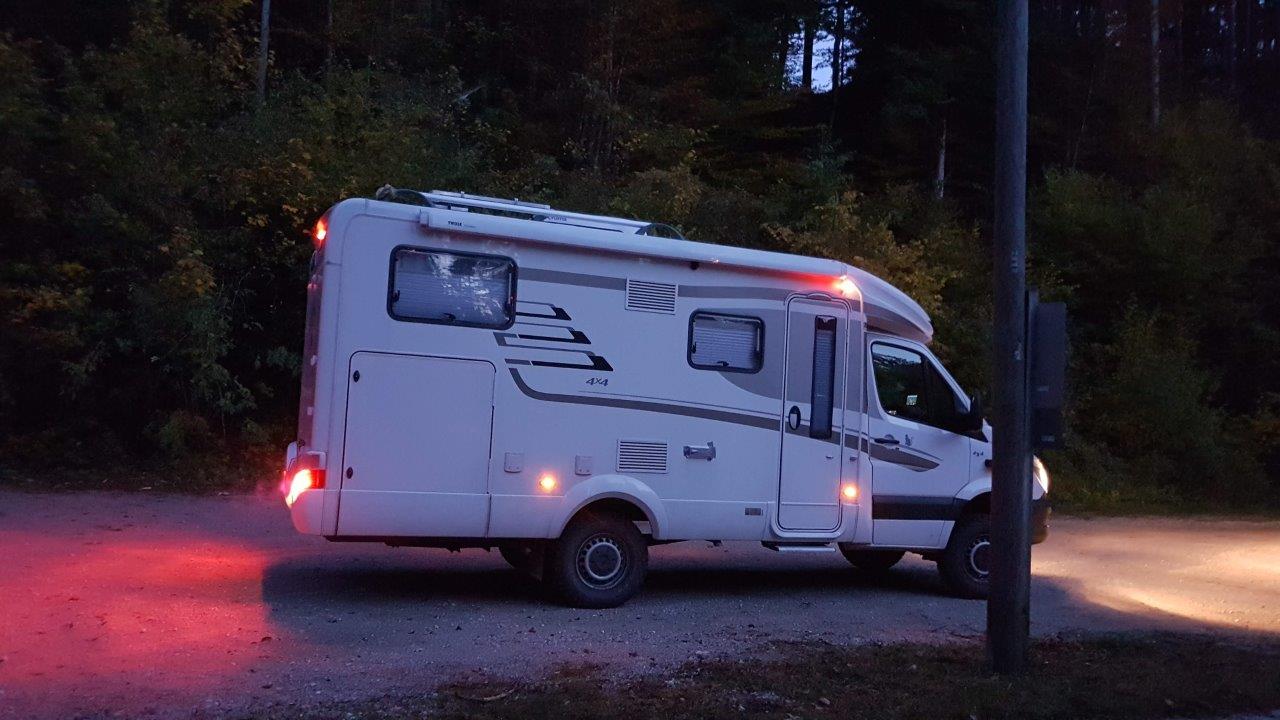
GPS: 47.7469444,14.2966667
3) Parking Lot Rettenbach, the upper place:
It is a parking lot on the same road, appr. 1.5 km above the lower parking lot, and for hikers only. There are no amenities, no water, and no toilets. Unfortunately, there is no mobile coverage. So we used this parking place as daily parking only during our hiking trail to the Hoher Nock – the highest peak of the national park. The details about the trail are here.
However, according to our opinion overnight there, it should not be a problem at all:
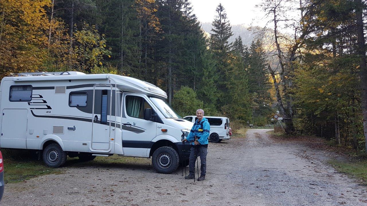
GPS: 47.7544444,14.3133333
Further official information about the park can be found here.
The visitors can explore the national park by hiking or mountain biking. We discovered the park in both ways.
500 kilometers of cycle paths and mountain bike trails in the Kalkalpen National Park Region offer variety-packed tours for all levels of condition. Routes lead to remote side valleys, through the canyons of the Reichraminger Hintergebirge, along scenic mountain roads, as well as to historic monuments such as old smithies and hammer mills.
Cycling and mountain biking are only permitted on marked routes.
Some bike paths are also designated hiking trails and bridle paths.
So always expect to encounter oncoming hikers or riders!
We did our mountain biking trail which was a combination of various existing trails, that we started and ended in the parking lot Reichraming, Weißenbachstraße 17 where we parked our camper (see above No.1).
The trail leads along asphalt or gravel paths mostly (more than 90%). There is a short difficult part leading along the meadow and forest narrow rocky path (appr. 1 km long), after you reach the chalet Ebenforstalm.
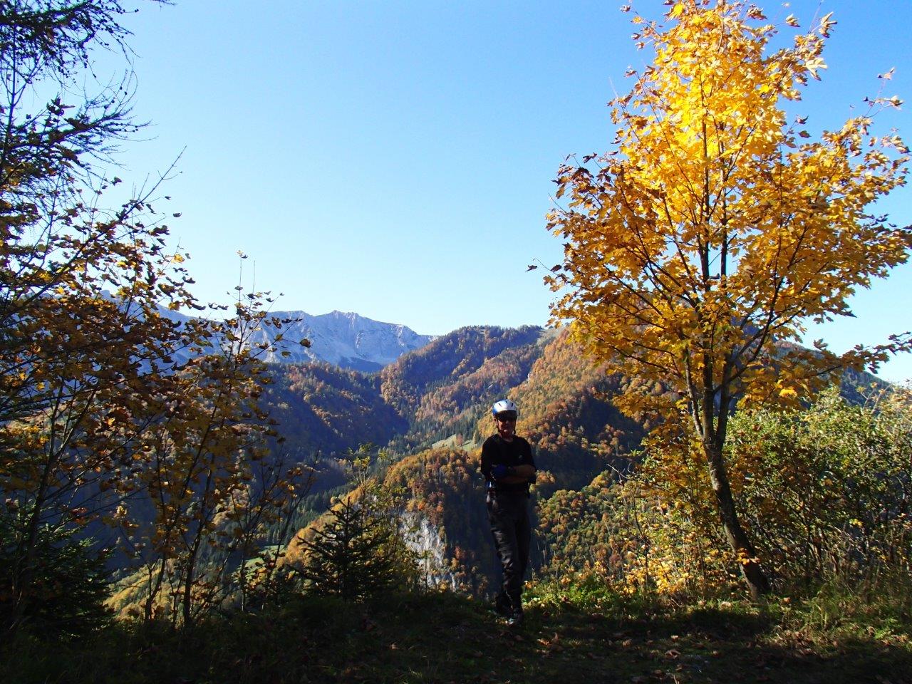
Kalkalpen National Park Mountain Biking
The map of our mountain biking trail that we named Kalkalpen National Park Loop is shown on the map, our trail is marked in purple with white arrows (paths in purple color only are biking trails too):
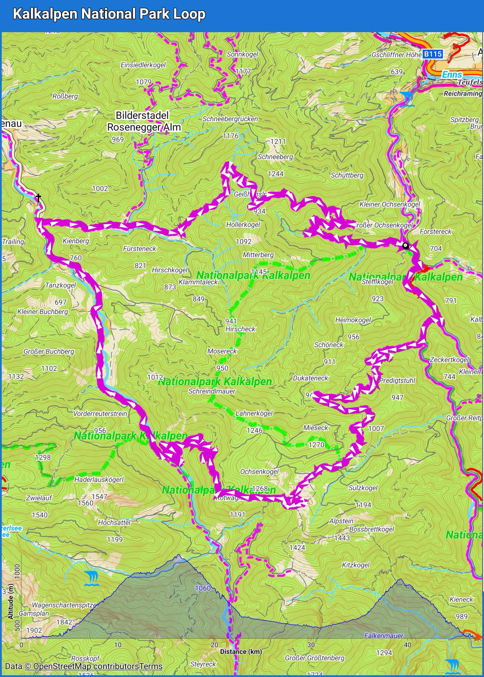
An interactive map of the trail together with the downloadable recorded gpx file you find here.
The photo gallery is here, and the video is here.
Hiking:
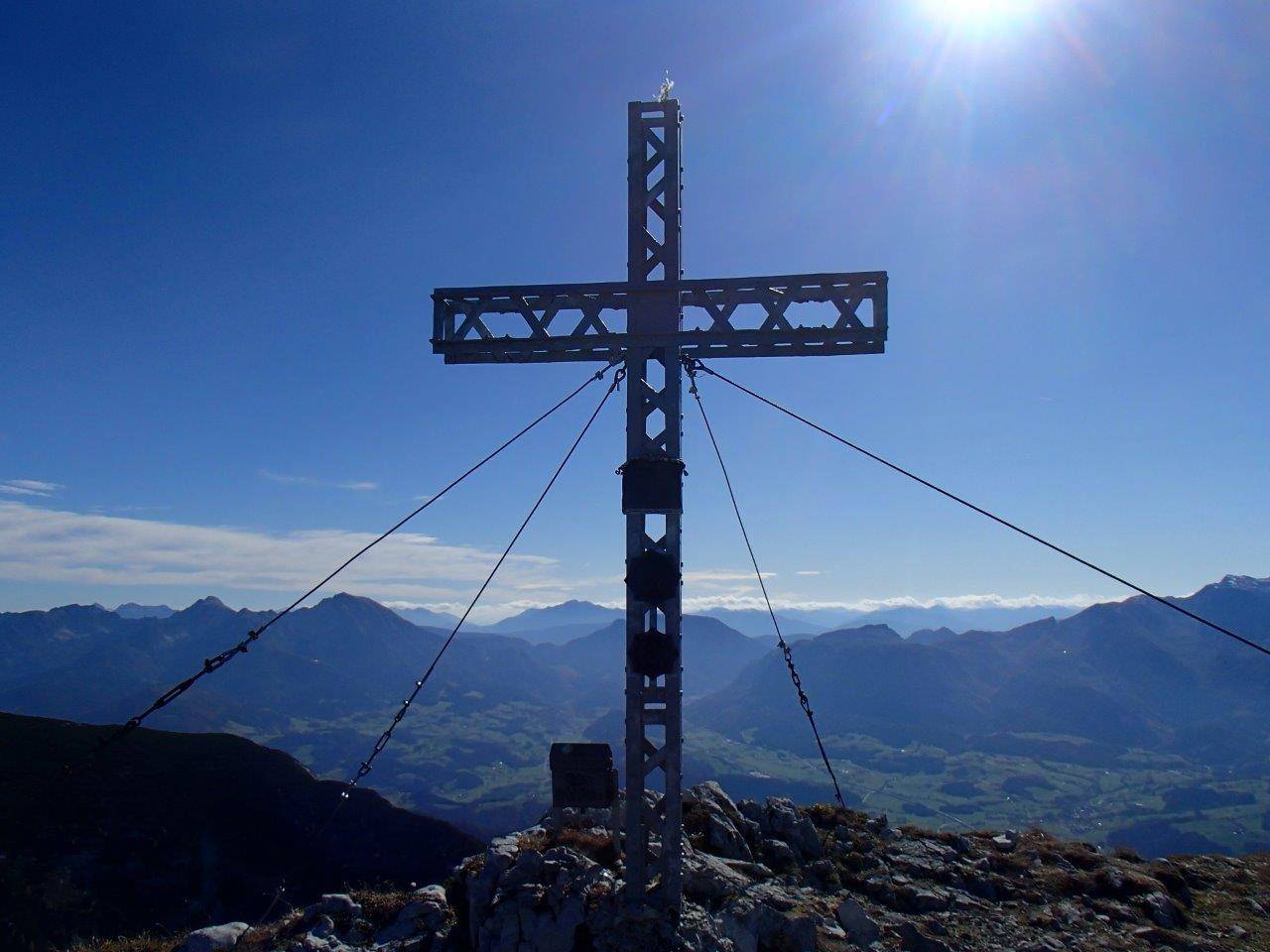
There are plenty of hiking trails in the territory of the park. We chose the hiking trail to the highest peak of the Kalkalpen National Park. Its name is Hoher Nock and its height officially is 1,963 m above sea level.
We started the hiking trail at the upper parking lot in Rettenbach (see No.3). It is a parking lot for hikers. The map details about the trail are here, our trail is marked in red with white:
The trial is very demanding. We needed nine hours to do it. However, we definitely recommend it. The peak is an amazing large plateau at the top and so you can enjoy unforgettable views of the Alps in all directions.
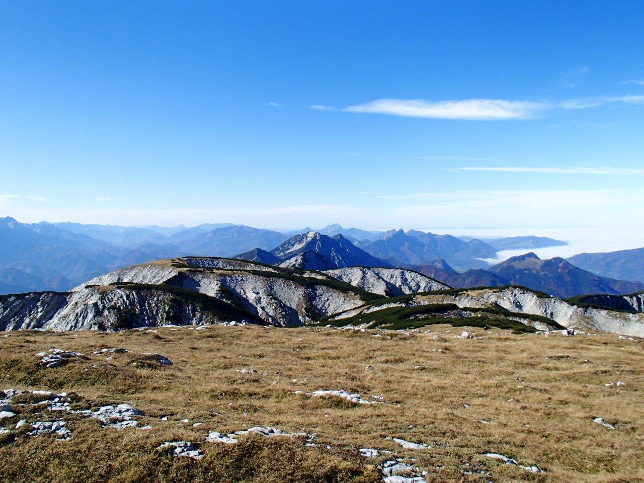
View from the Hoher Nock Peak
An interactive map of the trail together with the downloadable recorded gpx file you find here:
Visitor centers:
Kalkalpen National Park visitors’ centers are service points for hikers, bikers, and nature lovers. There are four visitor centers:
Molln Visitor Center is located in the town center of Molln. It can be reached by bike via the Steyrtal bike path, or by car on the B140(“Steyrtal-Bundesstraße”). You receive visitor information and you can see the Exhibition “Mountain Forest and Water World”.
National Park Visitors’ Center Ennstal is located between the towns of Reichraming and Großraming. The center shows and represents the beauty of nature and the strength of the whole Ennstal national park region.
National Park Panorama Tower Wurbauerkogel: The 21 m high tower offers a breathtaking panoramic view. Twenty-one 2,000 m peaks can be seen in clear weather: Totes Gebirge, Sengsengebirge, and Haller Mauern seem almost close enough to touch. The best way to reach the Wurbauerkogel is by riding the chair lift from the town of Windischgarsten, or on foot via marked hiking paths, by bike, or by car.
The Hengstpaßhütte has been newly built in Kalkalpen National Park in keeping with the design of older huts from the region. It is available to hikers or bikers and national park visitors as an information center. The Hengstpaß is one of the most popular hiking destinations in Kalkalpen National Park.
Attractions:
The main attraction of the park is nature. 200 km protected stream beds, 800 sources, 30 forest communities, 50 species of mammals, 80 species of breeding birds, 1,000 different species of flowering plants, moss and ferns, and 1,400 species of butterflies.
We recommend visiting the National Park Kalkalpen because of the following main reasons:
- It is a camper-friendly national park
- It is beautiful well-preserved nature with many species of animals and plants and flowers. The beauty of autumn nature can be seen in our photos here.
- There are plenty of hiking and mountain biking and cycling trails
Our videos were filmed in the territory of the National Park Kalkalpen you find here.
Enjoy!